Around the World in 80 Days (well, the US in 44-sort of)
54 replies to this topic
- 2005 ABS (Gen I) N. America
Posted 01 November 2014 - 11:29 PM

POPULAR
It's pretty far after the ride ended, but maybe some of you can read it while you wait for the snow to melt. I left Sac on 8/31 and got home 10/13. After that it was time to relax, so my family and I took a week-long camping vacation in Yosemite. I can’t do a daily report from the road; I don’t know how anybody can.
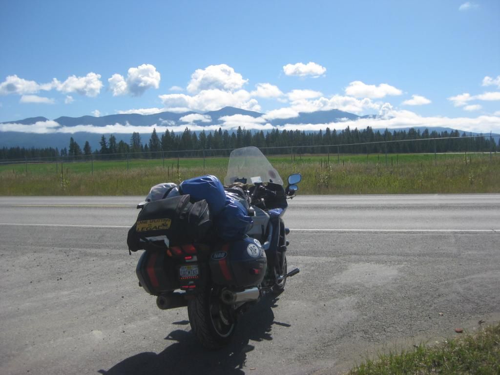
On this trip I camped when I could, and the rest was a mix of motels and enjoying the hospitality of family and forum friends, which I’ll get to later on. But for future long trips, I think I’ll just bag the camping. I do love settling into a campsite for the evening, relaxing with a fire, and the whole ambience of a nice quiet campground, but having to unpack and repack and stop in time to set up in daylight, and still having time to relax in that ideal evening camping time is too hectic if you need to make miles too. On the nights I camped, I didn’t have that kind of leisure.
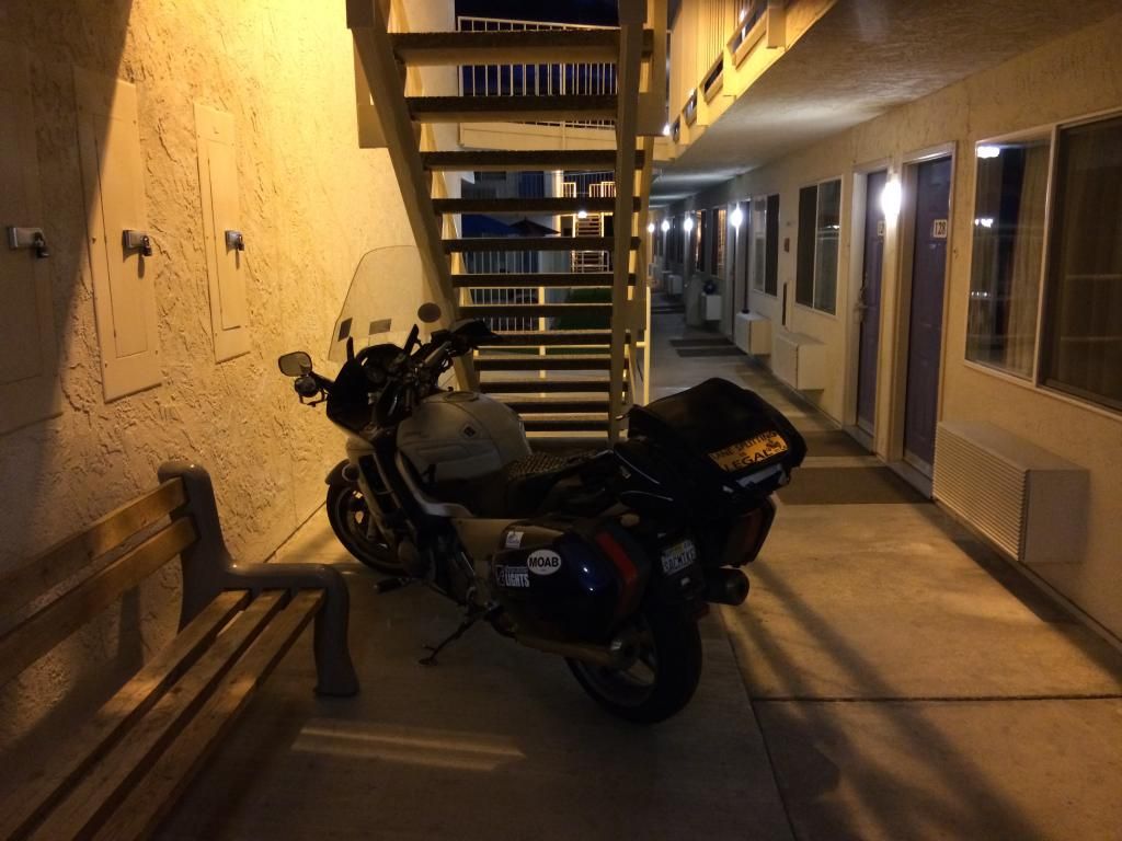
When I motel, I like covered parking.
I left here heading north, and cut over to the coast on the wonderful highway 36 (famous sign: wiggly arrow with the words “NEXT 140 MILES.” They should put a big smiley face on it too.) First night visiting my daughter in Eureka on the north coast where I visited the “Black Lightning Motorcycle Café” per FWFE’s recommendation, and headed up the coast. I always love that ride, though some complain it’s too slow and traffic-rich. I just like the views. FJRay had offered me a stop in LaPine (central) OR, but I was just getting going for the day when I’d have been near him. Mucho thanko for the offer, though, Ray (like Beemerdons, I like to spice up my posts with a little espanol). ")
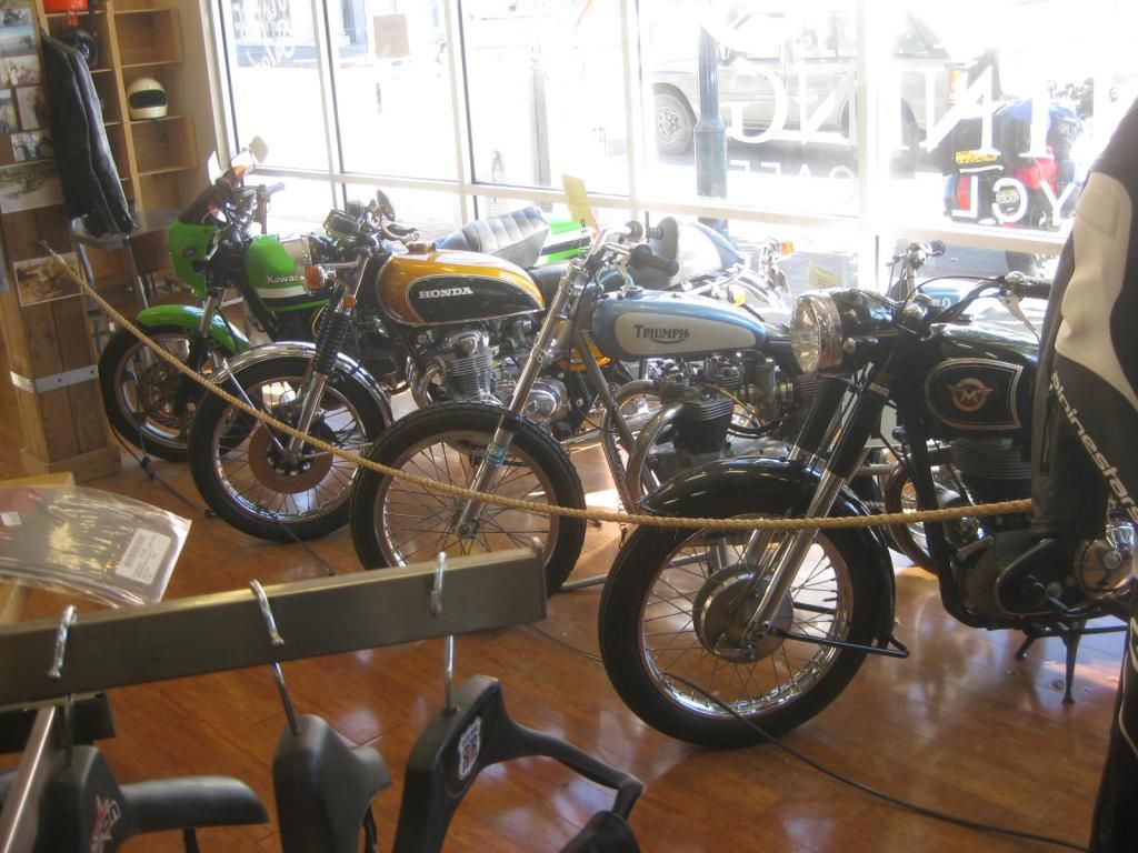
Black Lightning Motorcycle Cafe. Strange mix of food, classic bikes, and gear. Cool, interesting place.
Port Orford OR. Great spot to eat a sandwich
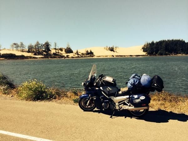
Oregon Dunes National Recreation Area
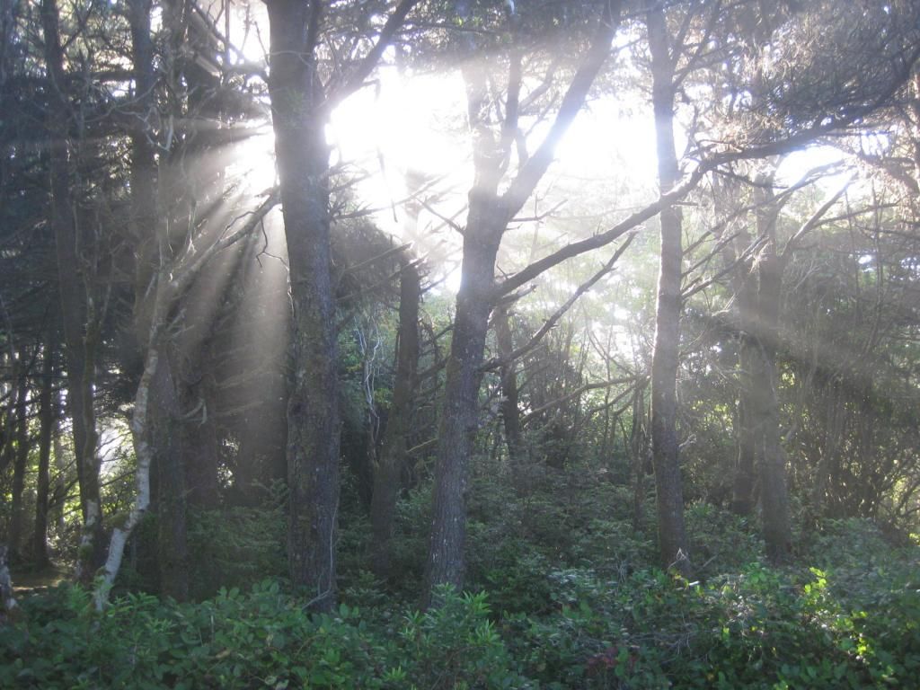
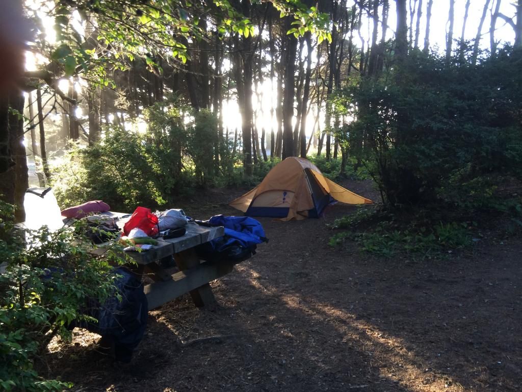
Coastal Forest Service campground in Oregon
I stuck to the coast (with a stop in that great NFS seaside campground above) until I was almost to Portland, then tried to find a way around the city. What a FAIL. Traffic, then construction, then detours. Slow ones. After all that, I headed down the Columbia River Gorge toward The Dalles (one of my favorite place names). Crossed into WA and then ID, where everything is named after either Lewis, or Clark, or both, and then north. I planned to cut east at the beautiful Sand Point and duplicate (in reverse) a 2007 ride I’d done, Rte. 200 toward Missoula, but decided to continue north to Bonner’s Ferry for Rte. 2, toward Kalispell and Glacier National Park to ride the Going to the Sun again. Pretty, but always slow and choked with cars and campers, but at least it was now after the Labor Day weekend. The spectacular waterfalls were depressingly dry, though, but at least the weather was clear. It was chilly—had been for the whole ride so far, but chilly is perfect, IMO. It was slow and muddy from construction coming down the east side and the bike got a long-lasting coat of mud.
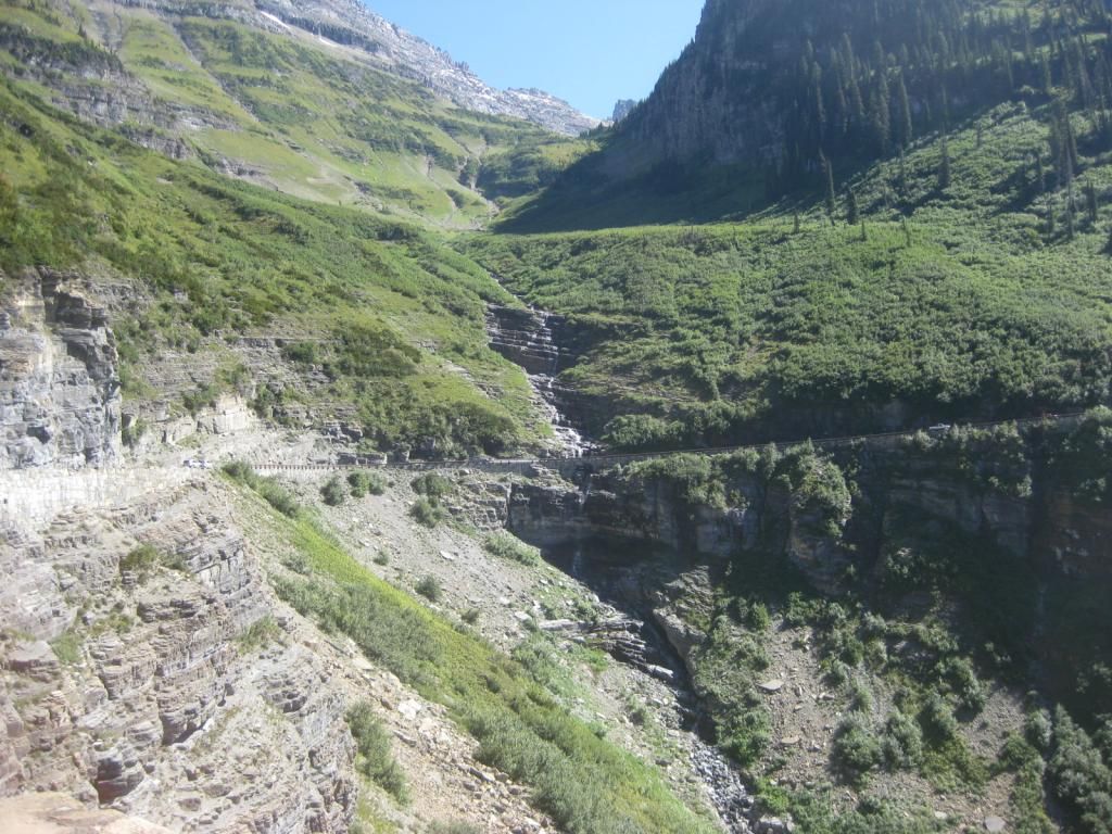
There should be a whole lot of waterfalls in this pic. Tough year for water all over the west.
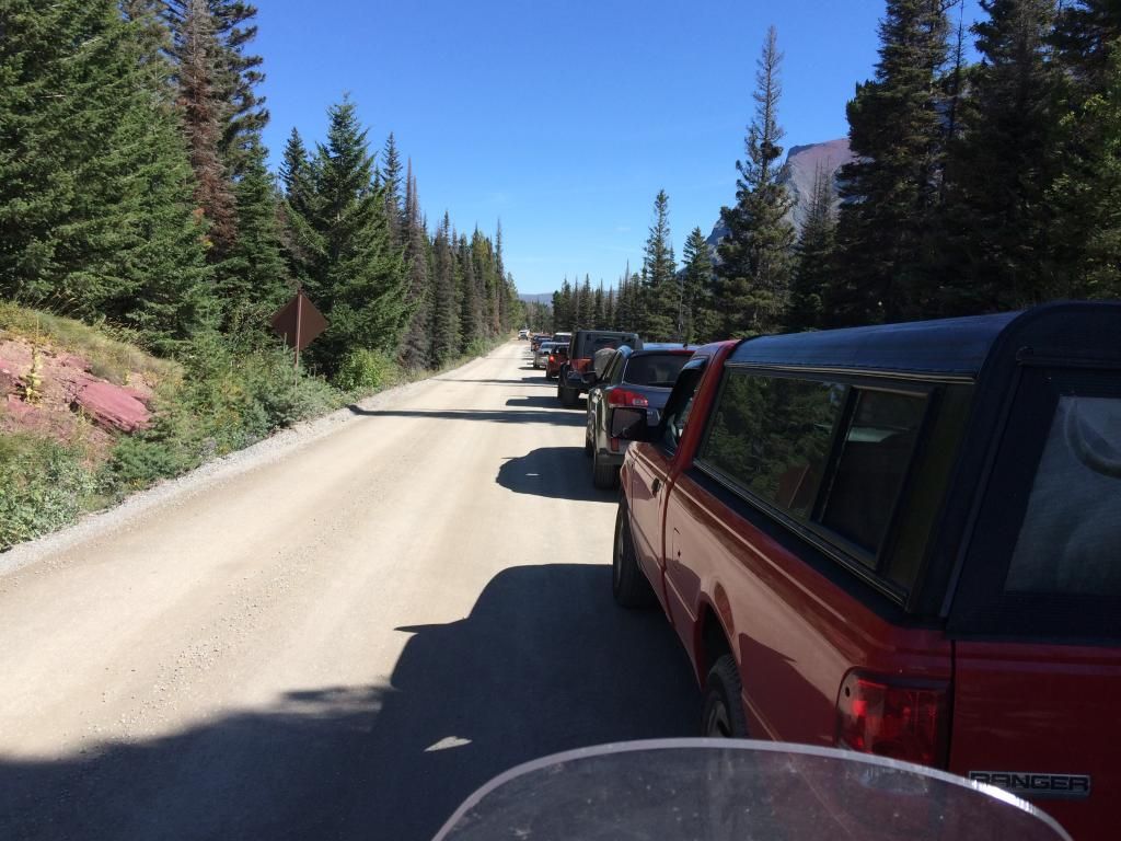
Realllly long construction delay after Logan Pass. Which got muddy.
Approaching Glacier. I just liked this shot.
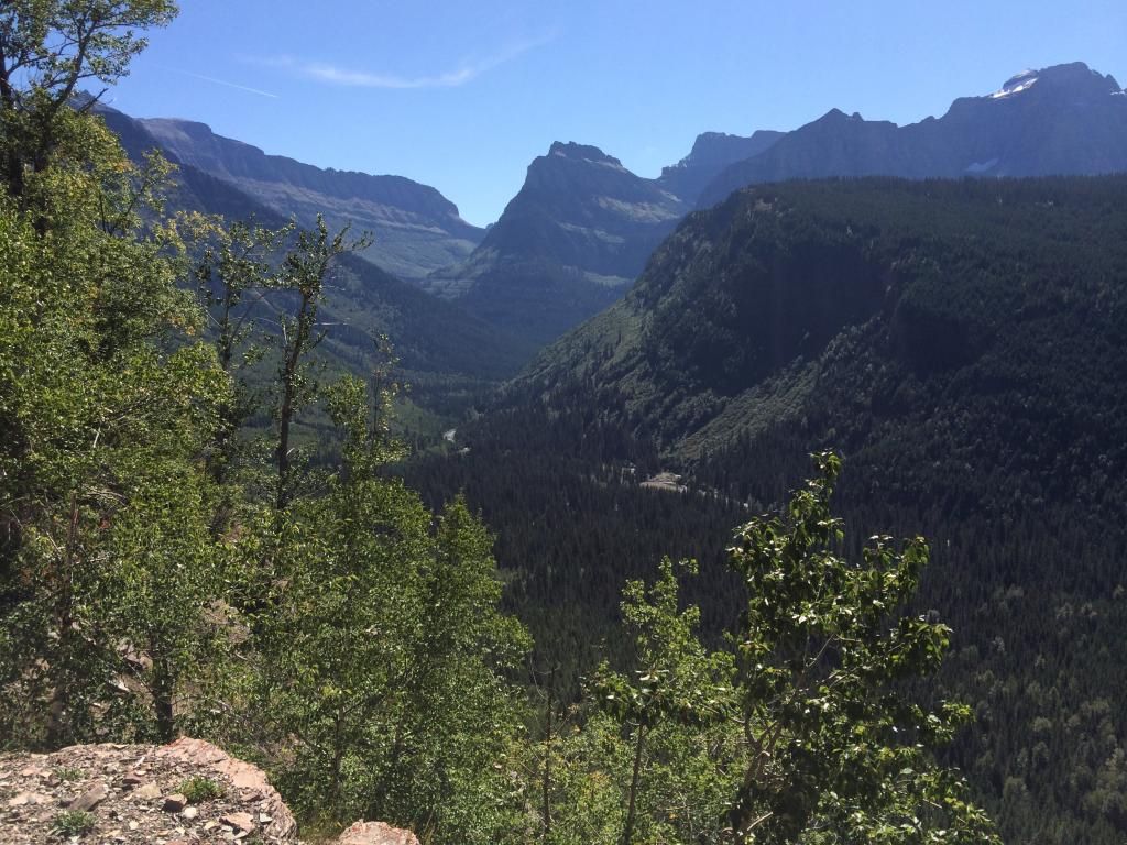
Going to the Sun was dry--but still spectacular.
Guess I'll post this much and see how much more I can do tonight. I'd hate to have the computer crash or something and have to start again.
"These are my principles. If you don't like them, I have others." Groucho Marx
"Consider the daffodil. And while you're doing that, I'll be over here, looking through your stuff." Jack Handy
"Watch out for that tree!" George of the Jungle


After I came down from Logan Pass, the summit of the Going to the Sun Road, I opted to pick up my pace eastward, foregoing the short run north from St. Mary to the back entrance to the park that dead-ends at the best part of GNP, Many Glacier. Last time there we saw multiple moose (feeding in a lake), mountain goats, bighorn sheep, and a grizzly bear, plus the very best scenery anywhere. I didn’t do it, but I highly recommend it. Even with a trip of this length, there are just sooo many things you want to do and have to skip, but at least this early in the ride, many of them I’d seen already. The things I skipped later on, I regret bitterly.
It was down into WY next, through Yellowstone (but just the corner--BTDT enough) and on to the wonderful Beartooth Highway. What a magnificent and FUN road—but skipped the lesser (to me) Chief Joseph, (again, BTDT anyway) for the sake of getting on with it.
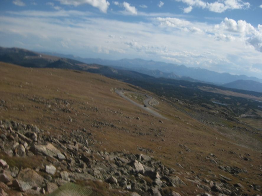
Beartooth Summit--10,947 feet. Not a lot of vegetation that high.
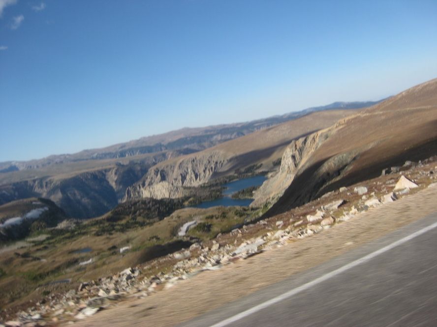
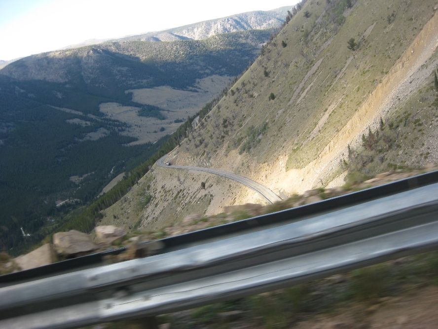
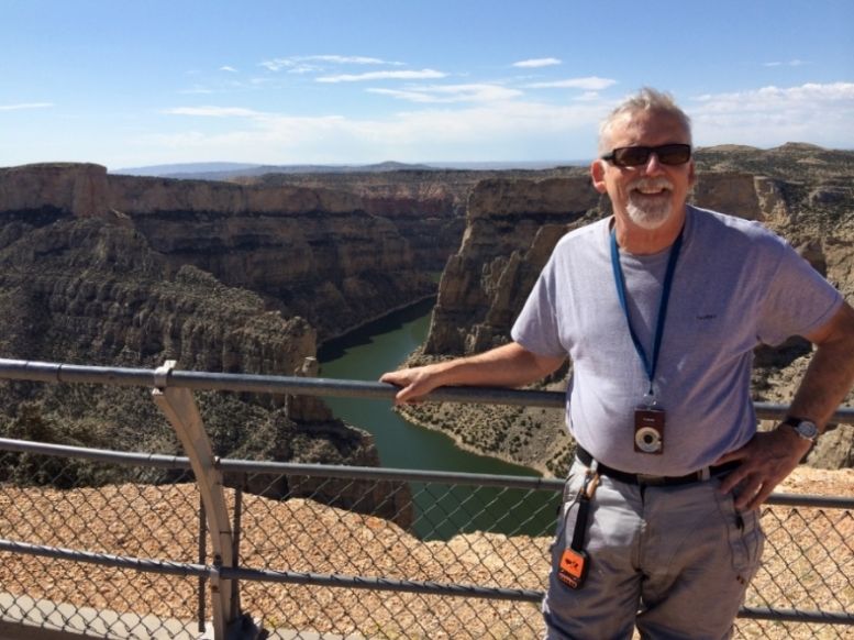
Continuing to get on with it, it was on to the Bighorn National Forest. Beautiful roads (Rte 14A, one of those National Scenic Byways. NEVER pass one by if you have a choice), beautiful views, damn cold at over 10,000 feet. Detoured into Bighorn Canyon National Recreation Area, because the views weren’t already spectacular enough. Sure enough, they got better.
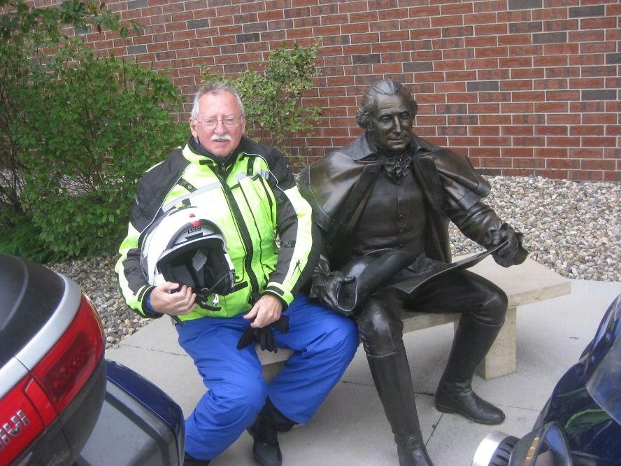
Next stop was Devil’s Tower, WY. Now it just looks like a big tree stump, but I thought it was really fascinating. My lifetime park pass saved me another fee as I rode up to the base. Let me tell you, “Close Encounters” was pure bullshit! Richard Dreyfuss could NEVER have climbed that thing, let alone that blonde he was with. It was very impressive—one of the most enduring images of the whole adventure.
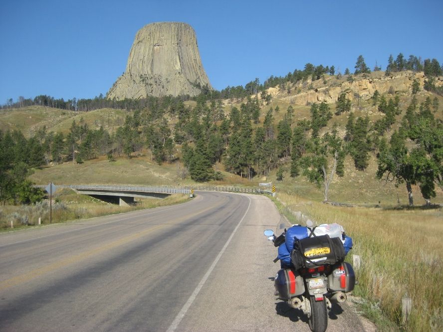
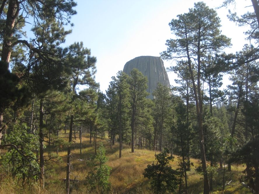
Good luck, Richard Dreyfuss
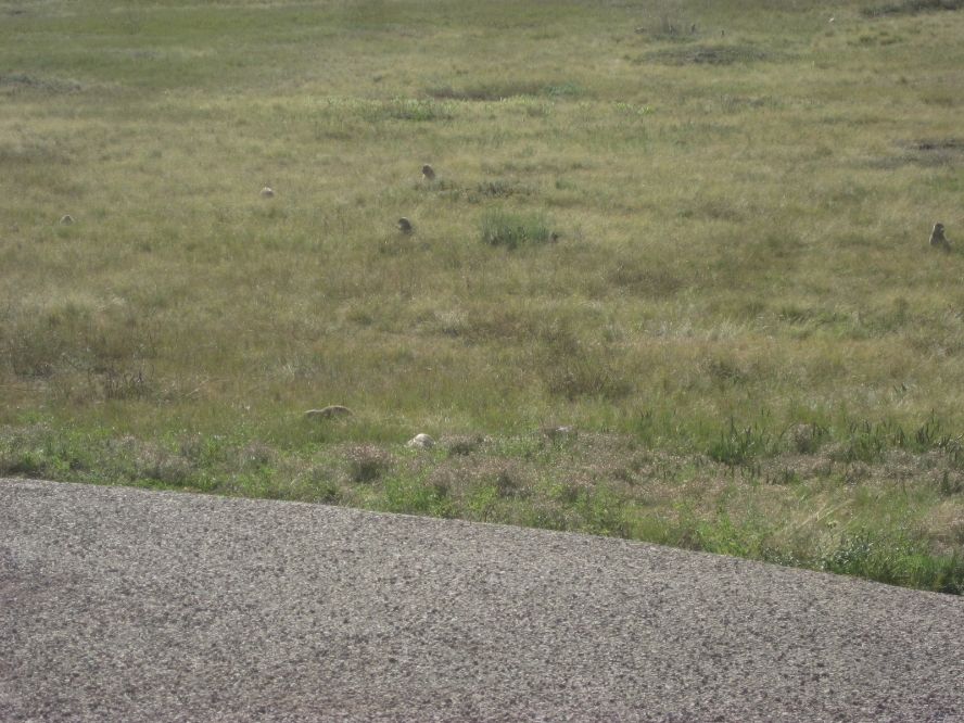
There's a prairie dog town at the foot of the Tower. Cute little buggers. Hundreds of them.
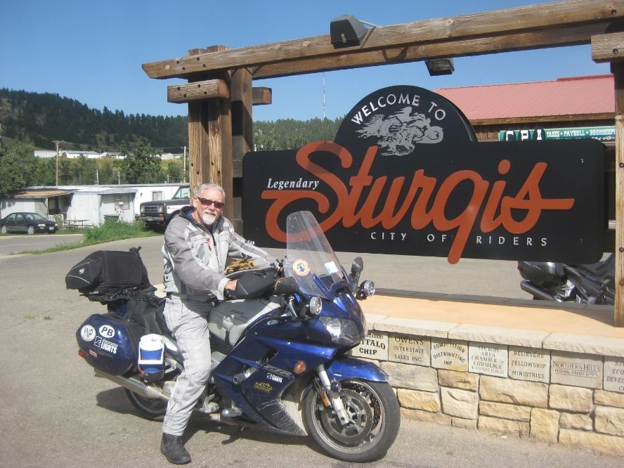
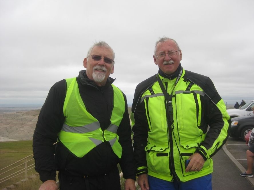
Big John SD had offered his hospitality, and the next day I got to Spearfish early enough in the day that John led me on a tour of local sights as soon as I had the bike lightened up by about the weight of a hefty pillion. It was a wonderful route of a couple hundred miles, I suppose, through places in the Black Hills that you HAVE to ride if you do the South Dakota run next June, like Spearfish Canyon and Vanocker Canyon. DO NOT MISS THAT ONE. We rode through Deadwood and Sturgis (stopped for the mandatory picture) and out to Mt. Rushmore and the Crazy Horse monument. Rushmore—I wish we’d gone in now. My natural tightness was offended when John told me it’s free to go in, but they charge $10 to park in the lot. And worse than that, it’s $10 whether you drive a 9-passenger van or an FJR! So we saw it from the road at a convenient overlook. It was pretty far away though, and now I wish I’d spent the ten. The dirty rats found a way around the lifetime pass we old guys enjoy. Wonder if other Nat’l Parks will follow?
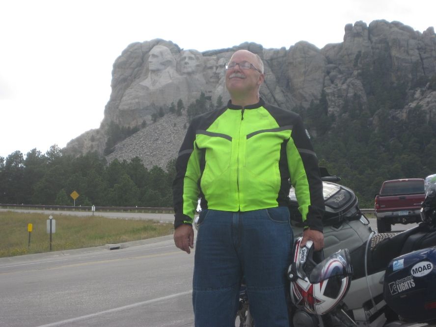
George, Thomas, Teddy, Abe . . . and John
One of those "I Was There" pics. By no means one of the top sights in SD.
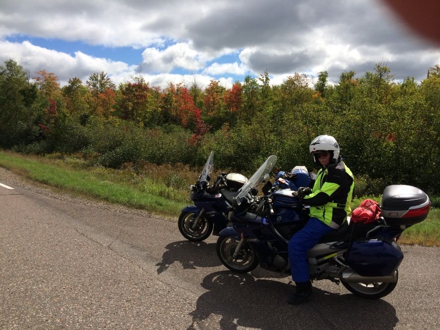
John and Jean gave me warm fuzzy hospitality that night, but the next day was threatening severe weather, so the best idea was to fly early. John had also offered Ralph—bikerskier—a bed for the next night, and he called John’s the evening before to discuss plans, but with the weather on the way, and after talking about it, he decided just to meet us for breakfast and then join me for a fast easterly run away from the front. So we all met in the morning and the joint ride with Ralph, on his epic 50-60-70 run, began. To be continued, again.
Posted 02 November 2014 - 08:25 PM
John, Ralph and I met for breakfast the next day--a gray and chilly morning. We left John behind to enjoy the snowstorm that was coming in. I understand they got three inches that day! Ralph and I stayed ahead of that, but couldn’t outrun the cold. It was gray and cold pretty much our whole three days together, but no worse—well, rain on the face shields a couple times, and just once had to put on rain gear, but that was largely to break the wind, which it worked great for.
The League of Elderly Gentlemen
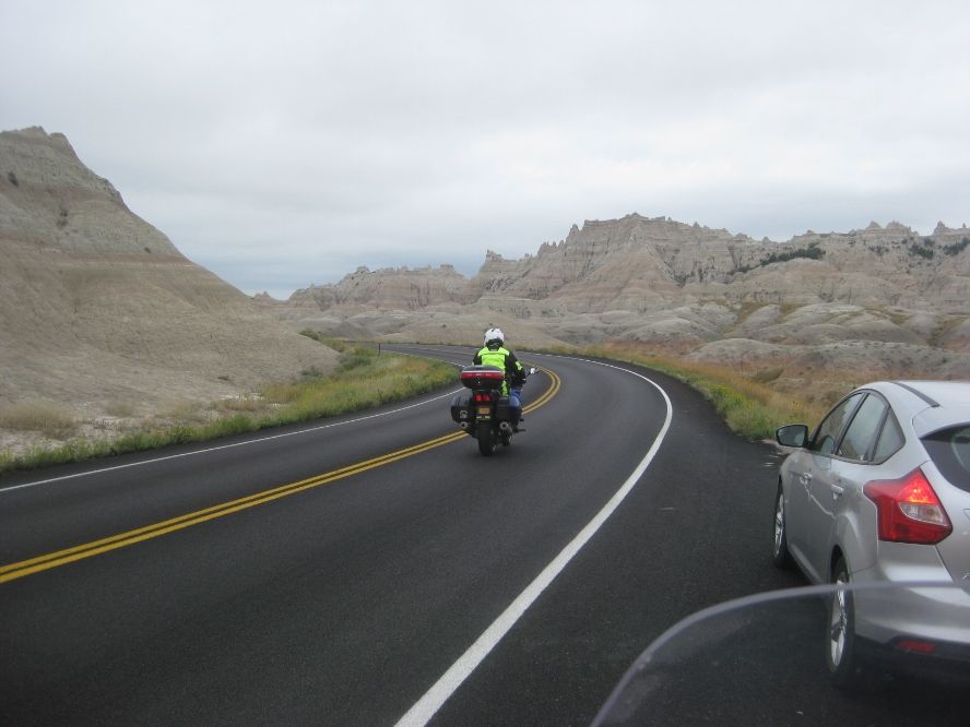
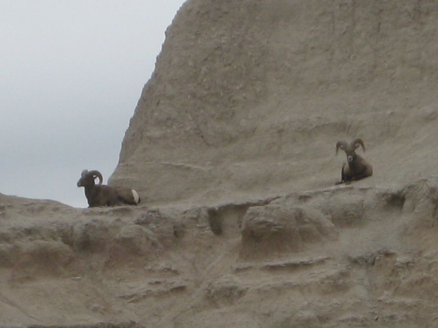
So we rode into the Badlands, which are pretty bad indeed. Bleak and desolate and uninviting, easy to see how some depressed pioneer might have given them that name. They looked like a much larger version of the part of Death Valley around Zabriskie Point, and the gray, forbidding weather only added to the feeling.
Two more Old Goats
On the road, my requirements for a motel are a locking door, a bed, and a working bathroom. Ralph lives to a higher standard, but splitting a room with him let me come up to his. Splitting a room with me, though, probably lowered Ralph’s, because when he rooms by himself there’s no one snoring loudly six feet away. He was nice enough not to complain about it though. Much.
Now, Ralph said some nice things about me in his RR, and courtesy dictates that I do the same, but I’d have done it anyway. He was great to travel with. For one important thing, we were compatible in our riding styles (read: “speed”), but also in how often we wanted to stop for a break, when to get up or get started, how far to go in a day, etc. These are all things that are fine if they are fine, but can mess up any trip with more than one rider. But I enjoyed his company a lot. I’d met him a couple of times before, but three days of traveling gave me a chance to get to know him, and I feel like I made a good friend. Funny, interesting guy. There, is that enough? One more thing—his ride was much more epic than mine. Longer and farther, I think he actually hit all “four corners” and beyond, going way up into the Maritime Provinces (Greenland too, I think). And Key West. And Alaska. Way to go, buddy.
AND, he cannot tell a lie!
John had recommended a ferry boat across Lake Michigan to bypass Chicago, which sounded good, but since Ralph was going to cross into Canada by Sault Ste Marie, we stayed together and made it to Marquette on Lake Superior our last night together. I liked the look and feel of the town, and its beautiful location. Leaving in the morning, the sun was rising over Lake Superior to our north (yes, I know, but it’s a big lake). Anyway, it was pretty gorgeous. The leaves were already beginning to change in the Upper Peninsula, the first I’d seen, so we had to stop and take a couple pics. Of course, they just got better as time went on. I found the countryside in Minnesota, Wisconsin, and Michigan very pretty. Most enjoyable country to ride.
It's really a place. AND a brand of butter!
The Yoopers get the fall colors before the rest of us, apparently.
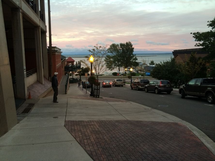
This is Marquette, which we liked.
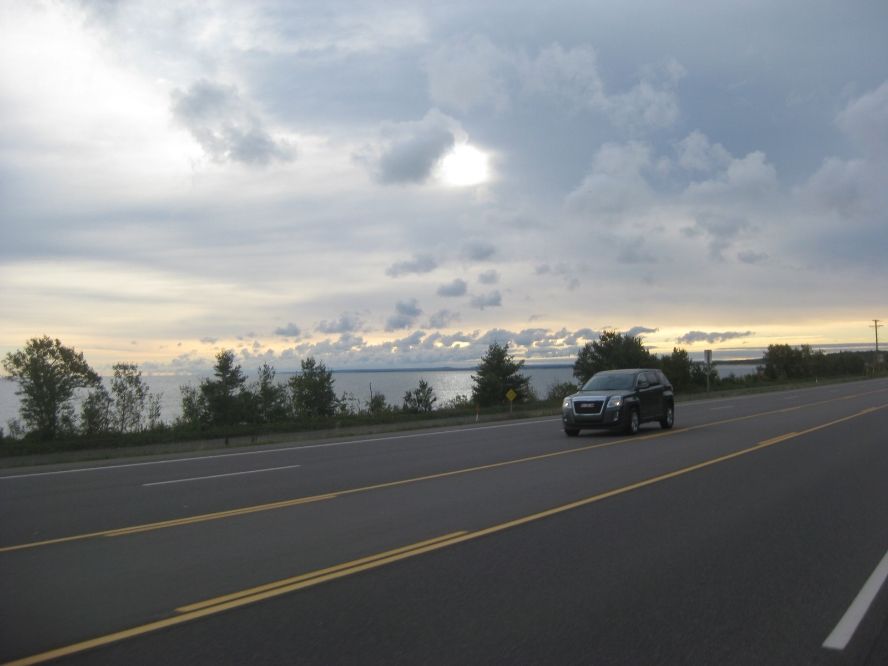
We were south of Lake Superior. So the sun MUST be rising in the north!
Next: Bust and Mizz Bust. And MORE!
Posted 03 November 2014 - 08:58 PM
Picking up the story in Michigan, early the next morning Ralph and I left Marquette and rode a very scenic 150 miles or so across the Upper Peninsula along Lake Superior until I had to turn right and Ralph continued straight into Canada. I crossed the Mackinac Bridge down into lower Michigan. My destination was Owosso, home of Bustanut Joker. I finally met the wonderful Sheila, aka Mizz Bustanut, a woman of warmth, charm, and patience. I think Bust married up.
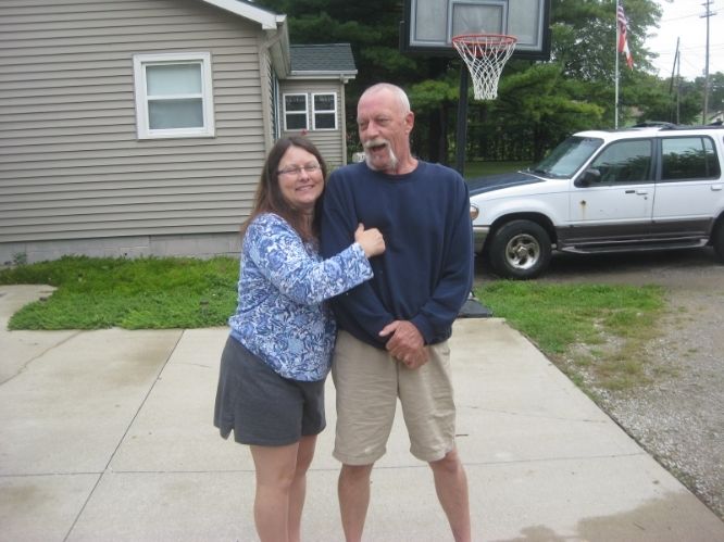
Sheila and Barry. I'm not saying she's too good for him . . .
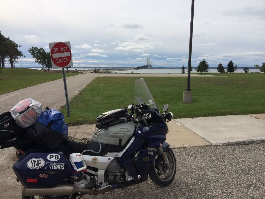
The bridge between Michigan and . . . Michigan. And you have to pay a toll to get there.
I enjoyed the evening with them, and Barry got on the phone with a couple of folks from Ohio and set up a meeting for me with the Bikergeeks (Andy and Sooz), and El Toro Joe. He mapped out my route to avoid Detroit (always a good idea) and meet the Geeks at an Ohio McD’s. Joe met us a few miles farther on, and they led me through some interesting back roads, mostly to avoid Cleveland. Nice country roads. They apologized some they couldn’t offer super mountain twisties or Isle of Man TT-level riding, but I was enjoying the rural eastern feel of the little towns. It was beginning to remind me of the countryside around Syracuse, my home town. Joe gave me some maps and recommended a place for a great Stromboli near the PA border that brings back fond memories. Very nice to meet you three, and thanks for the escort!
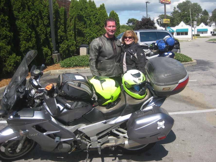
The Bikergeeks--Andy and Sooz
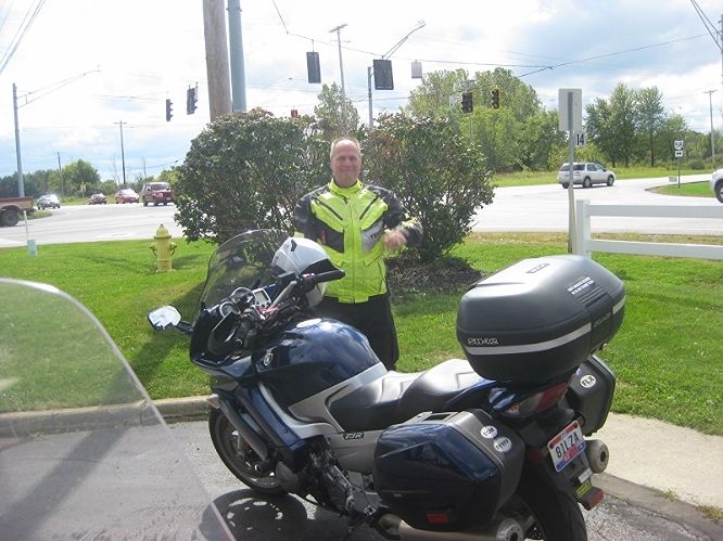
El Toro Joe. NO IDEA why all my pictures are coming out all random sizes! 
Anyway, then I was off to Buffalo, where my sister and nieces live with their families. It was good to see everybody—it’s been a lot of years. Little children are now adults and unborn babies are now taller than I am. Jeez. It was a short ride, and the quickest route involved the New York State Thruway, a road I can’t recommend. I caught a break when I hurried the first couple Thruway miles to catch up with an FJR that had gone through the booth just before me. I was closing on him and cooking pretty good when his brake lights came on and he made some frantic downward hand gestures. I came down fast and looked up to see the NY State Trooper in the median, parked 90 degrees to the road. He must have been looking north, because he sure would have nailed me if he’d seen me coming. My closest call of the trip.
That rider wasn’t on the forum except to look in once or twice. I only met a few fellow FJR folks on the whole ride; two who had them at home, one young guy from Georgia riding with his dad on his BMW, two more at the top of the Beartooth, one in DC, and another at a Burger King near the Dragon in NC. That was about it. FJR riders are an exclusive club.
For the next 9 or 10 days it was New York State tourist stuff and visiting family and old friends with my wife and her sister who flew in to Buffalo to meet up. I have to see Niagara Falls every visit; they never fail to impress. We took the Maid of the Mist ride and toured the “Cave of the Winds”—climbing up and down wooden walkways and stairs right below the American Falls. It was like being a reporter standing on the beach when a hurricane comes in—but it was great fun. They give you a raincoat and plastic sandals that keep you from getting all wet. For about five seconds. And it was cold and windy, so the next couple hours were not really comfortable. But I still give it two thumbs up.
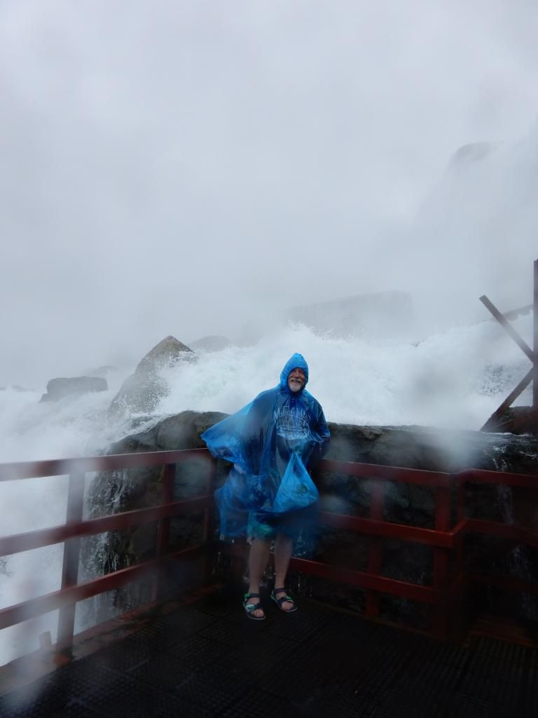
I needed more protection than a free raincoat and sandals.
After Buffalo I rode back to Syracuse, but parked the bike in my niece’s garage. We visited for a while but then switched to a rented car to hit some high spots around Central NYS--the very scenic Finger Lakes, Seneca Falls (the town “It’s a Wonderful Life” was supposedly set in), Watkins Glen, Where we climbed up and down all 800 steps through the gorge, Cooperstown, and then headed north for the Adirondacks. We took a float plane tour from around Old Forge over the amazing fall colors. Locals told us we were there at the very peak of the season. I know I’ve never seen them brighter. We took a boat tour around a few dozen of the beautiful Thousand Islands, and then headed back to CNY for the last weekend. Then it was back on the bike for me and the girls headed toward Boston via VT and NH for a short look before heading home.
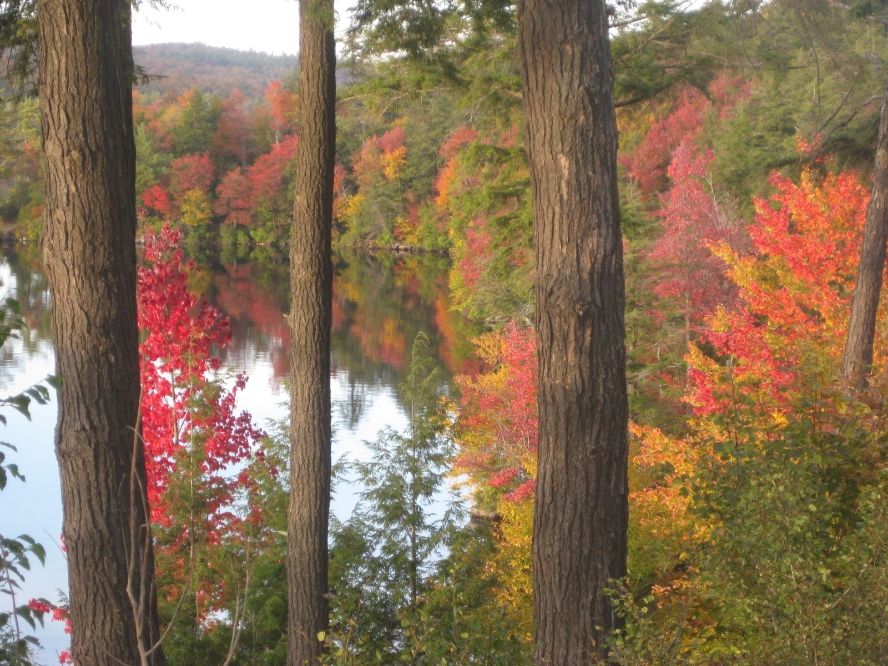
Colors were amazing
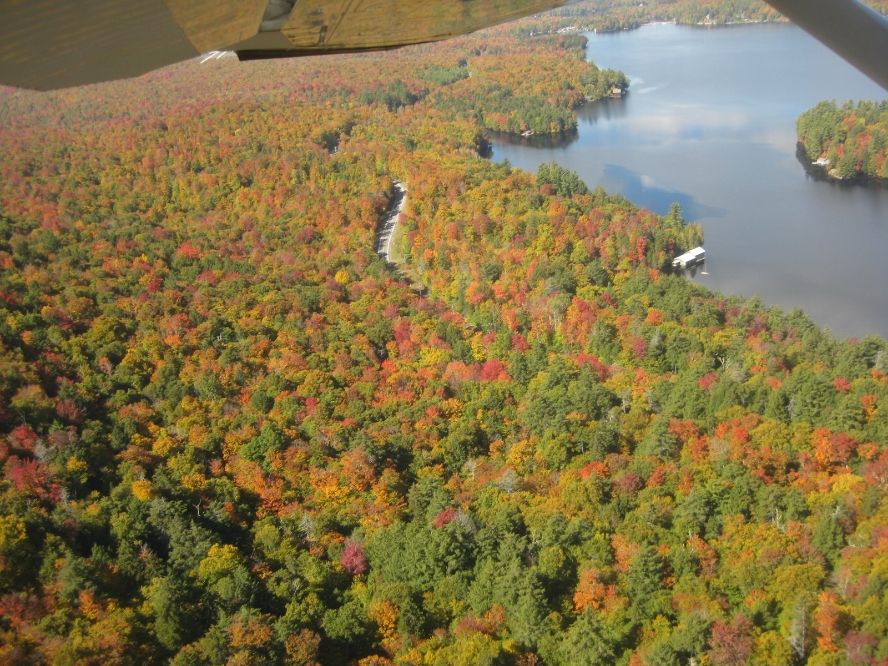
Even better from the plane
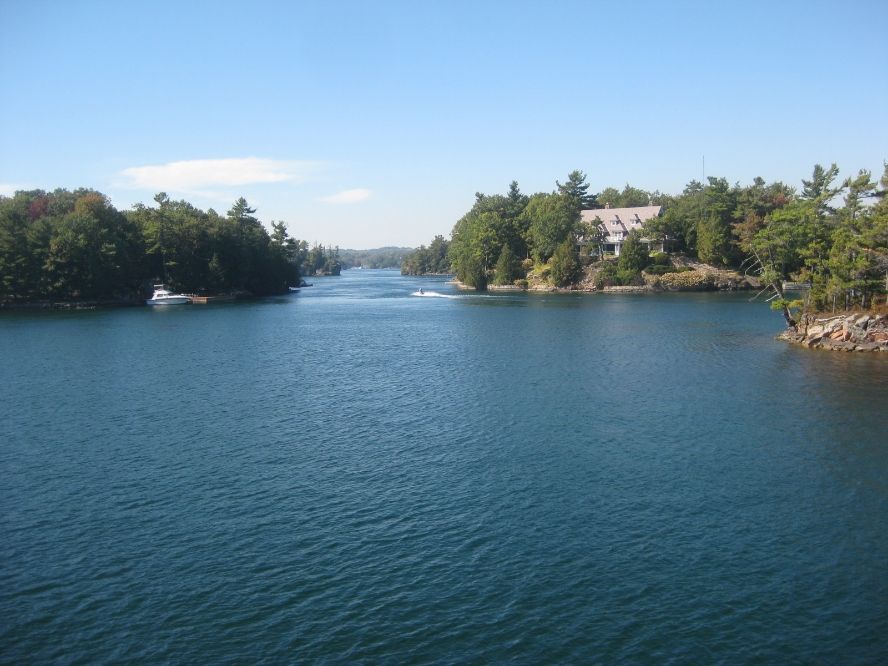
Just a few of the Thousand Islands
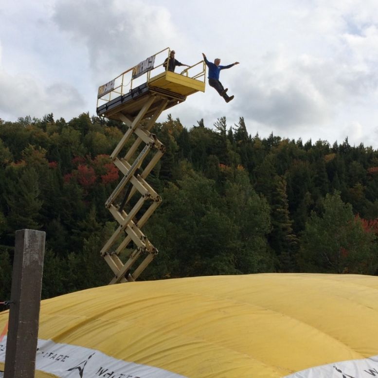
Not acting my age on Whiteface Mountain. And it looked MUCH higher from up there.
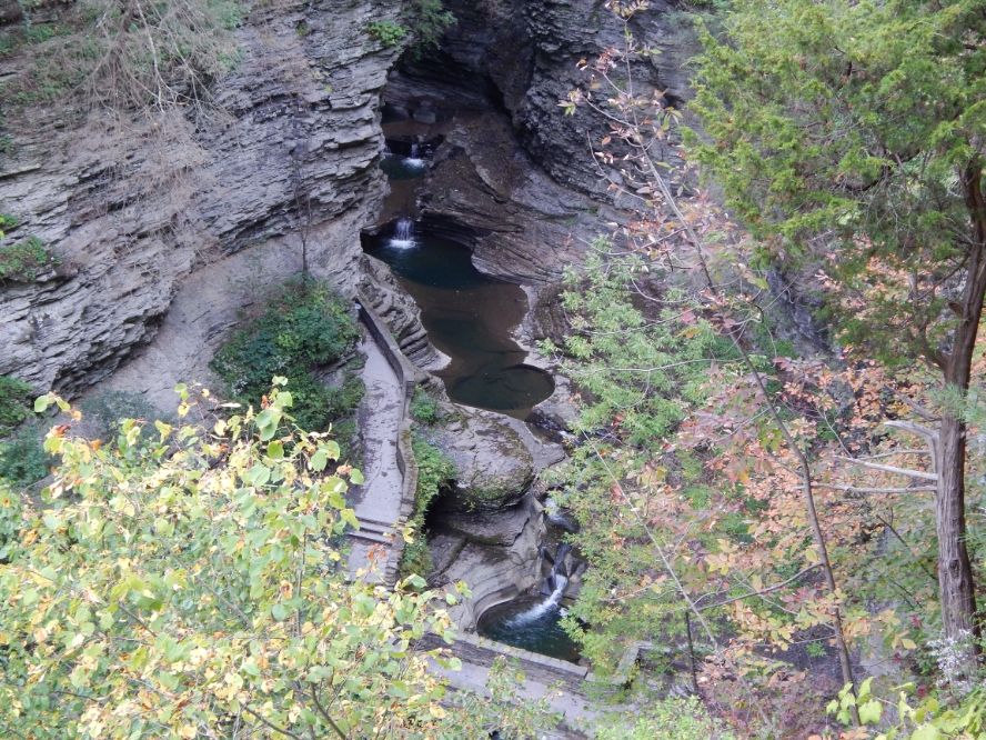
Watkins Glen
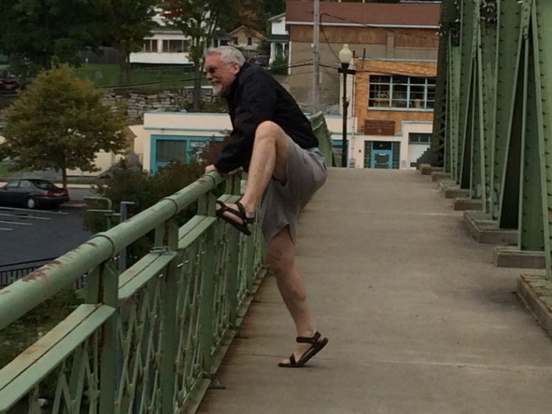
Re-enacting Jimmy Stewart's big scene.
Next up: Heading south--the motorcycle part resumes.
Posted 04 November 2014 - 12:46 PM
Holy cow, I just clicked on Ralph's 50-60-70 Spotwalla link. There are so many waypoints on the map, you can barely see North America! And now it looks like he's getting very close to home in Portland. So congratulations to him, but I'd better finish this up before he posts his ride and while anybody's still reading this one.
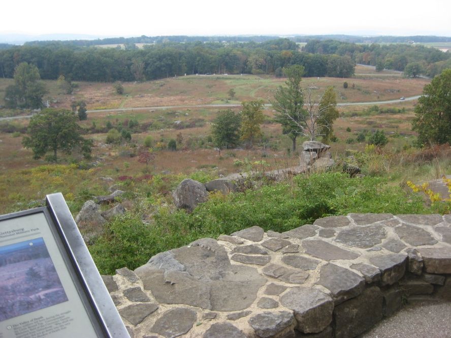
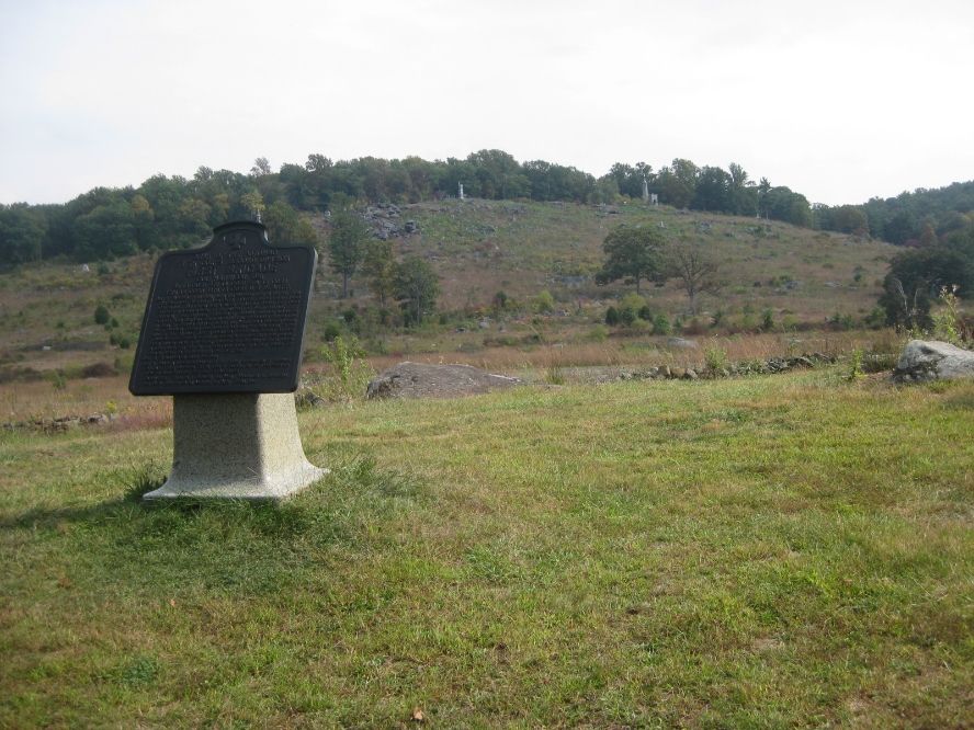
I said goodbye to everybody in NY and headed south through Pennsylvania. Every state seems to have signs that say the same thing in different ways—wear your seatbelt, but I liked PA’s best: “Wear Seatbelts Next Million Miles.”  They have plenty of beautiful scenery in PA, too. I didn’t make it all the way to my next goal, Gettysburg, that night, but hit it pretty early the following morning. It was sobering to see, of course. I rode the self-guided tour of the battlefield, which is immense. It includes the whole nearby town and literally miles of nearby countryside, covered with statues and monuments of various companies and regiments and Great Leaders who were involved. Just seeing the landscape, and imagining (trying to imagine) what it must have been like for everybody from both sides . . . Wow. You can stand on top of the hill at Little Round Top, for example, and look down at the field below that the Confederates had to come up, or stand at the bottom and imagine the Union troops up among the rocks, firing cannons and everything else down. It’s a horrible thought, but a very moving place to be.
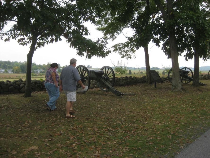
Seminary Ridge. Below, Little Round Top, looking down, then looking up from below. Neither place would have been a good place to be in July, 1863
My next scheduled visit was with Lisa (LCB on the forum) and her husband Will. Two kids (Ian goes into the USMC in April) their daughter Lee, and a giant, FRIENDLY dog, Lothar. I mean Lothar was really friendly. And really giant. I made it there right at the end of a good riding day that included the Gettysburg tour. Lisa and Will offered me wonderful hospitality, a stack of maps for the rest of my trip, a spot in the garage with their five bikes (including Lisa’s Hayabusa) and even took me out to dinner with the family. Thank you SO much for everything. Folks like that make the forum what it is, for sure. Technical information is important, but it doesn’t hold a candle to the sense of community we share here.
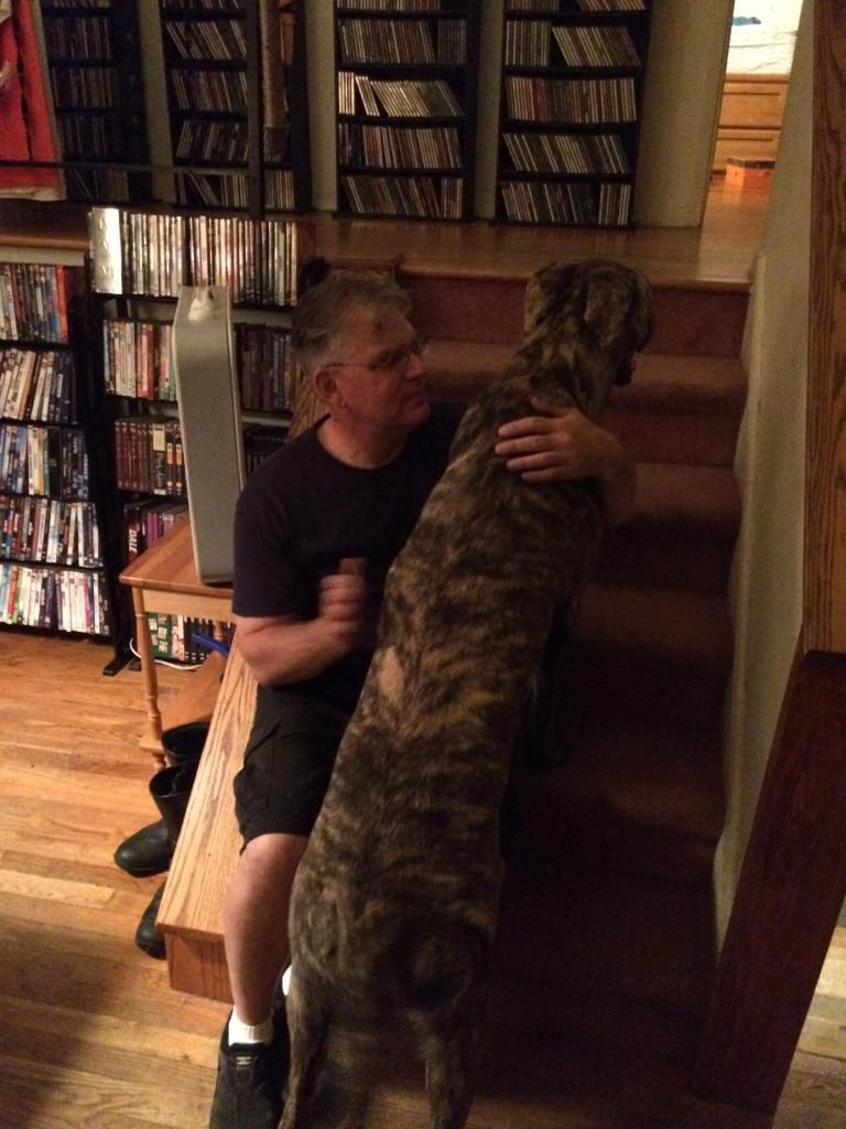
Lisa, Will. and Lothar. The lower one gives a better sense of Lothar.  Not a very good model. Wouldn't hold still for pictures!
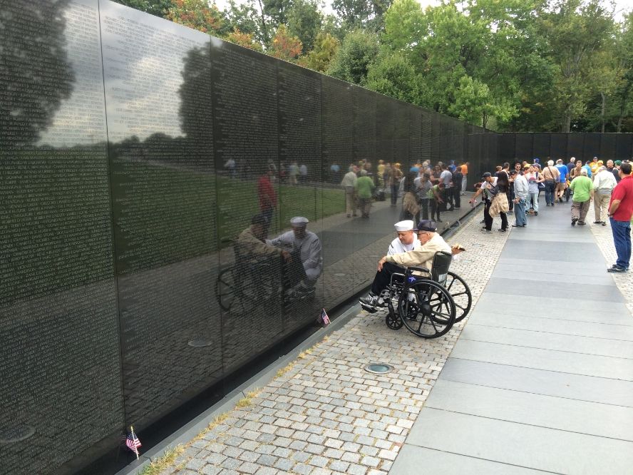
I left them on Wednesday morning for Washington DC, where the slogan on the license plates is “Taxation Without Representation.” Guess they’re a little bitter about not having a vote in Congress. DC is NOT motorcycle friendly. No place to park, horrible traffic, roadblocks and local and federal police everywhere. I couldn’t even get close enough to the White House to see it, let alone park and take pictures or whatever. Mind you, this is like two days after that goofball jumped the fence and ran inside past all kinds of security. I guess the chief of the Secret Service resigned the day I was there. I did manage to park and walk over by the Lincoln Memorial, the reflecting pool and the Washington Monument, and walked down through the Vietnam and Korean War Memorials. Heavy.
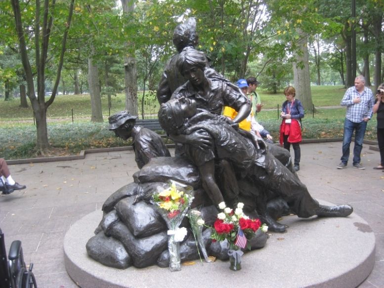
This statue honoring the nurses in Vietnam really killed me.
Mid-afternoon, and it was time to get the heck out of DC. Someday I’ll go back and really see it, but when I do I’ll be staying as near as possible and taking taxis or tour buses.
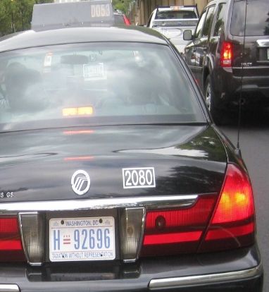
Blurry, but says "Taxation Without Representation." Better slogan would be: "Worst. Traffic. Ever."
"These are my principles. If you don't like them, I have others." Groucho Marx
"Consider the daffodil. And while you're doing that, I'll be over here, looking through your stuff." Jack Handy
"Watch out for that tree!" George of the Jungle
Posted 05 November 2014 - 01:19 PM
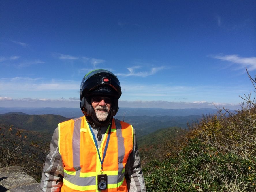
My easy destination after DC was Front Royal, VA, the beginning of Skyline Drive and the Shenandoah National Park. I understand the scenery there is pretty spectacular. My view of it was mostly as seen below, at least for the first forty or fifty miles. The fog eventually lifted, but the speed limit of 35 was kind of slow for an FJR. I may have exceeded it some. The bumper stickers call it “America’s Favorite Drive,” not “America’s Favorite Ride.” Still, the part I could see was good.
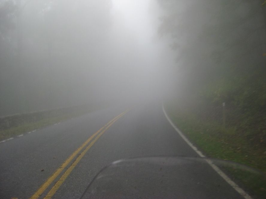
This wasn't bad, considering how foggy it got later.
Skyline Drive becomes the Blue Ridge Parkway, where at least the limit jumps to 45. I found enforcement to be light (maybe I was just lucky) and again, probably exceeded even that once or twice. I got off for gas in Roanoke but back on again to find a campground that didn’t look too far on the map. It was, though—I barely made it to Rocky Knoll campground and got the tent up before pitch dark set in. I loved the place names—made me know for sure I was in the South. Something “Knoll,” something “Knob,” Hollows, Wallows, Runs, Notches, and Gaps. Seems more colorful than the names of places where I’ve lived. I had other clues I was in the South too.
Never ran across this before, so it must be a Southern thang. And speaking of that . . .
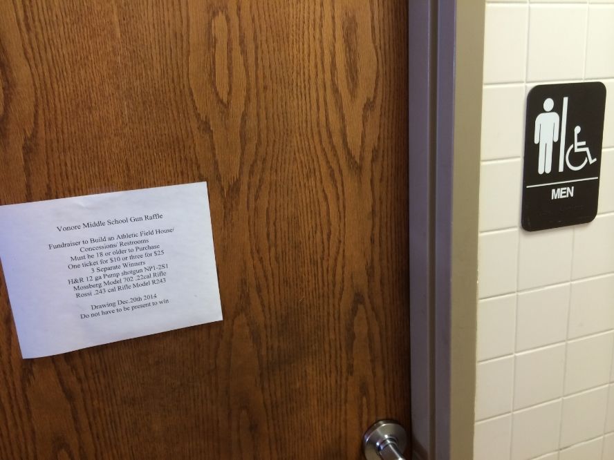
Here's something else I never saw before either. A little out of sequence, found in a Tennessee hardware store, but guaranteed never to be seen in California. Or Canada. Middle School? Really?
Anyway, continuing down the BRP the next day, which began as a gorgeous day, it began to cloud up. A lot. I pulled over as it became obvious I was heading into a storm and got my rain gear on. The extra warmth was welcome too. In a few miles I came to the Blue Ridge Music Center, an NPS facility along the parkway, and saw a sign: “Music Today.” I almost rode by, but went back to find what was a lot like a normal visitor center, but devoted to the music of the area, with an attached open performance area where over a dozen musicians were sitting around playing great mountain music on guitars, fiddles, banjos, and mandolins. I guess they were just local folks who enjoyed coming in and playing together—it was certainly no kind of a formal staged concert, but the music was terrific. There were people watching too, but probably fewer than the number of musicians playing. http://www.blueridgemusiccenter.org/
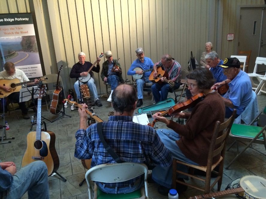
I watched for a while, from practically inside their circle. The players were almost as interested in my ride, especially when they found out I’d come so far, as I was in the music, and asked me all about it. The rain started just as I was about to leave, and I got lots of good wishes for my safety and advice to be careful and stay dry. That was tough, since it was now raining hard. That wasn’t so bad—my gear proved to be as waterproof as I could have hoped, but as I climbed again, the visibility went straight into the crapper. I was moving maybe 25, barely seeing a couple of lines ahead in the road, until I came up on a camper that was doing under 20 with its lights flashing. I decided 20 was fine so I followed him for several miles. There really was no choice; no place to stop except a couple of turnouts, where I’d be standing in the rain instead of riding in it.
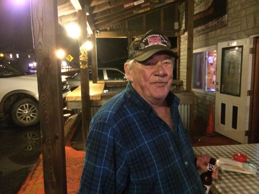
I was more than glad to take the first exit that came along, Laurel Springs NC, and my Parkway map showed much-needed gas could be had a couple miles east. I got the gas first and then turned back to the Stations Inn Motorcycle Resort, which sounds maybe a little more grand than it looked. A couple Harleys stood out front in the rain, and the riders were on the porch, drinking beer. Turned out they’d already checked in, though it was before 3:00, so I decided they were maybe OK after all. After exchanging greetings, I joined them for lunch, and decided to stay there too, so I got in on the beer as well. Turned out they were Steve and Dwight, childhood buds from Black Mountain, NC, just off the BRP. Once a year Dwight rides south and Steve rides north to ride the Parkway together. After a while, and another beer or two, they went up to their rooms and returned with a pair of guitars! The rest of the evening was another Blue Ridge music festival, with everybody in the joint (maybe 8 of us) trying to sing along if we knew the words. Which we didn’t, mostly. These were a couple of damn good guys, ol’ Steve and Dwight, and to confound the first impression I might have given, Dwight is a PhD Georgetown graduate in aeronautical engineering—a blooming rocket scientist! Works for a subsidiary of Aerojet General and has worked at their Sacramento facility where rocket engines are made and tested.
Among the chorus on the porch were the self-proclaimed great-grandnephew or something of Doc Holliday of OK Corral fame (who was also named “Doc” Holliday), and a young woman claiming kinship with the man—I think she said his name was Tom Dooney—who inspired the song “Hang Down Your Head Tom Dooley.” Guess that scans better. I think I believed them both.
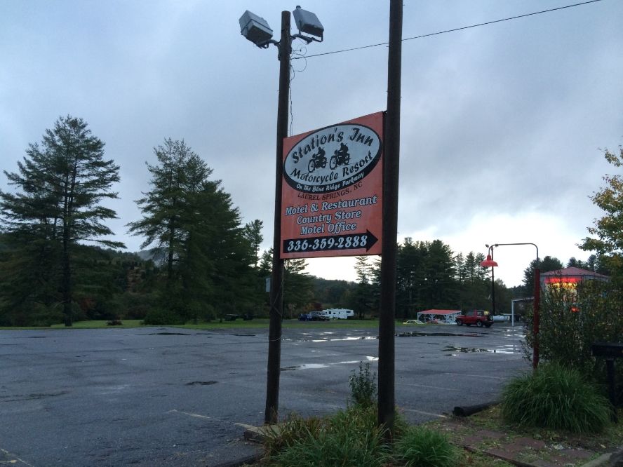
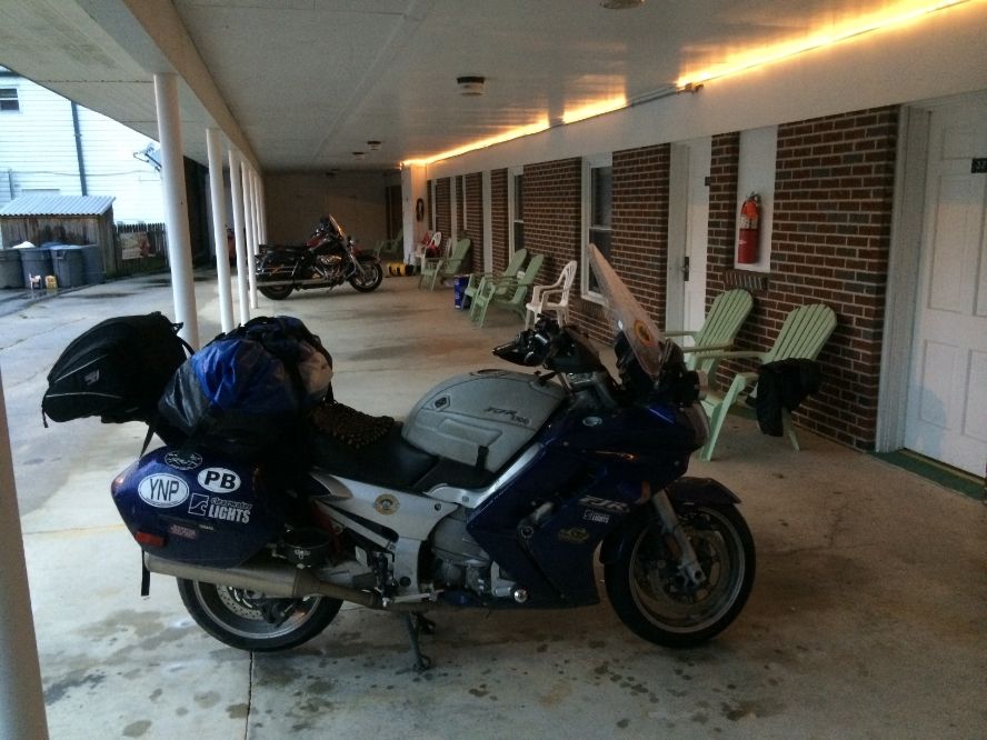
Great parking for a rainy day
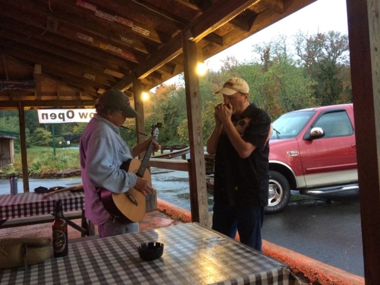
Steve and Dwight. Or Dwight and Steve. I'm not sure who gets top billing.
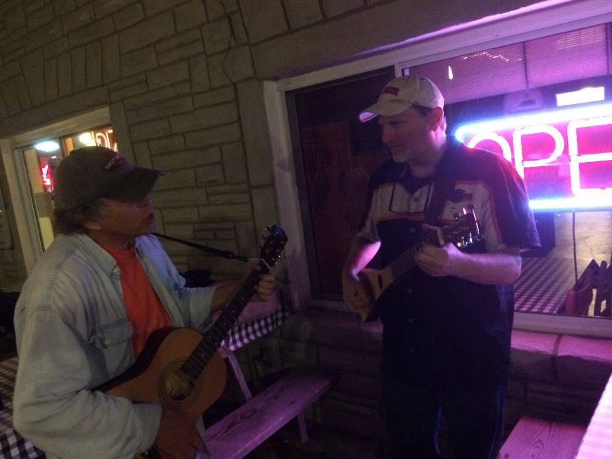
The party continued into the wee hours.
Meet Doc Holliday. Not a real doctor.
I’ll tell you, it wouldn’t hurt to plan to end a day on the Blue Ridge Parkway at this joint if you ever have the chance. It really is designed for the motorcycle set. Covered parking in front of your room, good food, low cost, friendly folks, and cheap enough to satisfy even—me. I’m giving it three thumbs up. And BTW, at the urging of my new friends, I breakfasted on biscuits and gravy and a nice bowl of grits! They were, um . . . filling. No picture of the grits. Just picture a bowl of pure white . . . sand.
"These are my principles. If you don't like them, I have others." Groucho Marx"Consider the daffodil. And while you're doing that, I'll be over here, looking through your stuff." Jack Handy"Watch out for that tree!" George of the Jungle
Posted 05 November 2014 - 06:24 PM
Thanks for the comments, all y'all (see how the South gets to you?).
All that nasty weather was on Friday, but Saturday was beautiful--but cold again. The visibility on the Parkway was almost unlimited, and the views spectacular both east and west. The road just follows the ridge, as the name implies, for the whole length of the range. Toward the south end, I pulled up at a visitor center on top of Mt. Mitchell, a place called Craggy Gardens. Boy, it was cold. So I asked inside: “how cold?” It was 27 degrees!
It was time for the balaclava.
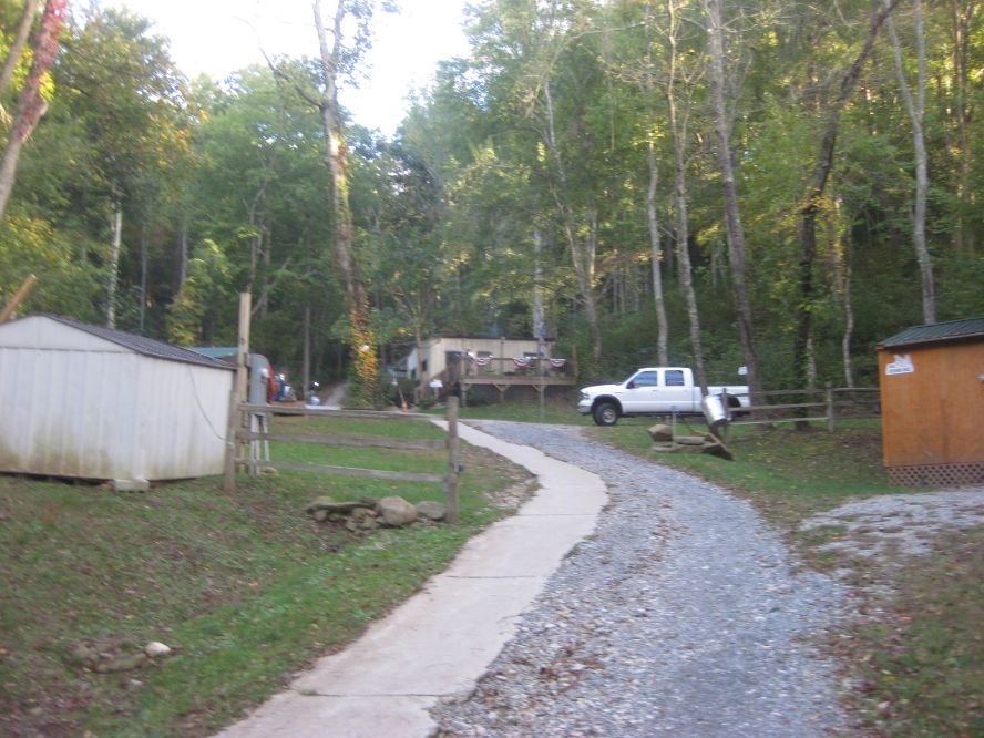
Got off for lunch in Asheville, a pretty hip college town kind of place. Portlandia East. I’d have liked to explore, but I wanted to slay that Dragon. Made it to Robbinsville, where I found a very interesting place to stay at “The Simple Life Campground and Cabins,” with the cabins lined up straight up the side of a steep hill where I got a cabin the size of a jail cell for $27. Mine was called “The Bear’s Den,” with paintings and statues of bears, stuffed bears, and a bear-design bedspread. Cute bears, too, with lace curtains and frills all over. Owner’s wife had interior decorator dreams. But it was clean and just fine, with electricity, wi-fi, a good clean bathroom with showers up the hill—all you needed was a sleeping bag. It even had an air conditioner in the window, though a heater would have been much more welcome this cold night. I still give it three raised thumbs. By the way, what I said before about not bringing camping gear on future long rides—I now modify to say I’ll bring the few things I’d need to stay in cabins like this one—KOA-style places. I like them.
The Simple LIfe--straight up the side of a steep hill
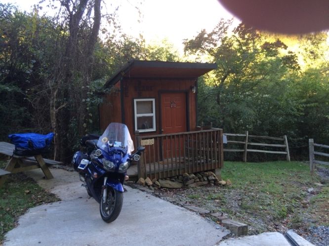
This is not the outhouse. This is my cabin.
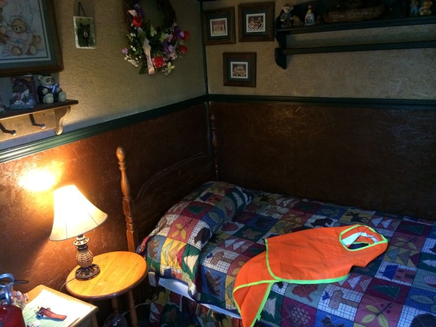
Inside was surprising!
Next day, the Dragon. To be continued . . .
"These are my principles. If you don't like them, I have others." Groucho Marx
"Consider the daffodil. And while you're doing that, I'll be over here, looking through your stuff." Jack Handy
"Watch out for that tree!" George of the Jungle
Not Safe For Work
Posted 07 November 2014 - 11:05 AM
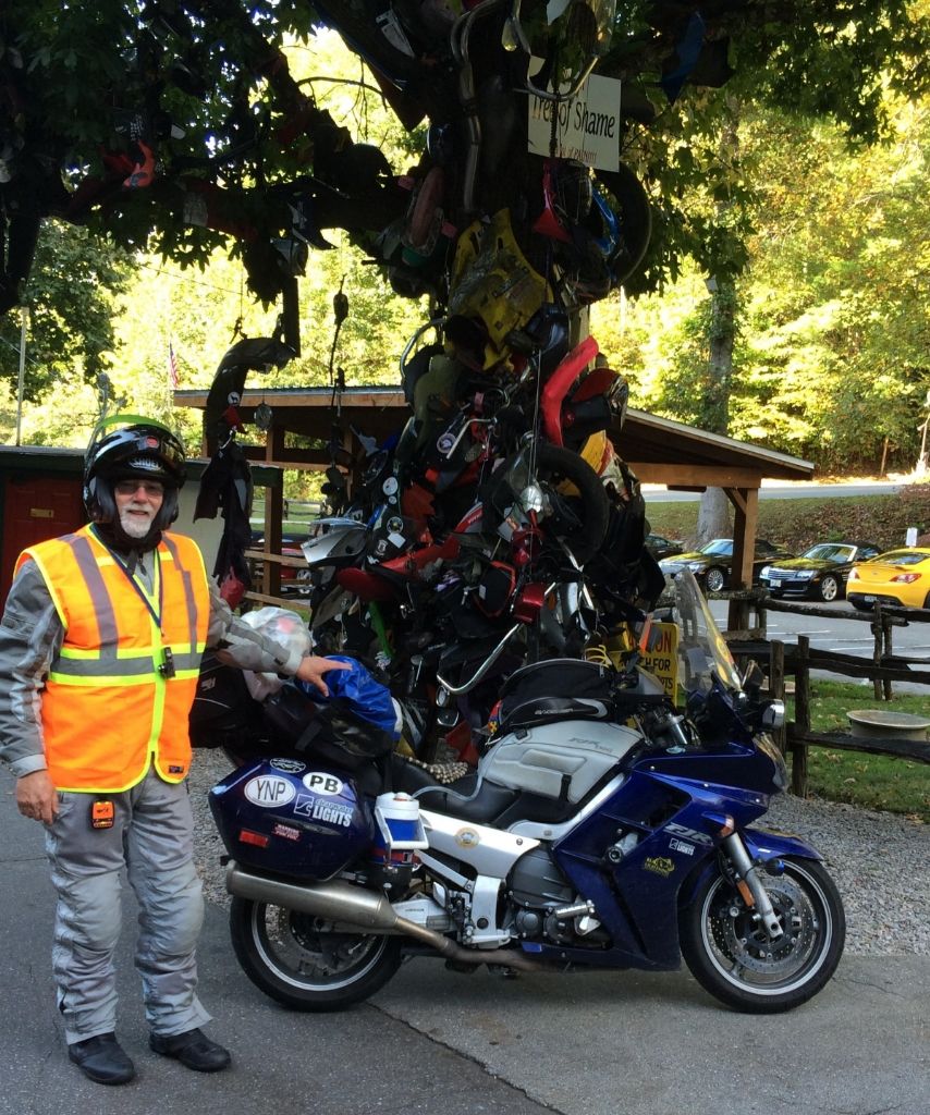
The next morning--another beautiful day--I headed out for . . . the Dragon. Have to admit, I had kind of an attitude about that road. 11 miles? Hah. We’re pretty proud of our roads around here. But I arrived at the “Deals Gap Motorcycle Resort” (see a pattern?) in the morning and saw about 50 motorcycles in the parking lot, plus a bunch of hot-looking sports cars ready for their run. I took a pic next to the Tree of Shame, swearing it was the closest my bike and that tree would ever be.
I went inside the giant souvenir shop to look for a tshirt. I’d come 6,000 miles already and this was the only tshirt I bought—the power of marketing. Oozing cynicism, I took my run at those 318 curves. OK, it was fun. OK, it was really fun. It won me over. I couldn’t help really pushing through it, hanging off the bike in the curves, trying to do it right. And I had a blast. Traffic was light that early on Sunday morning. Nobody passed me or tried to, nobody held me up. No semi-trucks or formations of Harleys, just a damn fun, pretty road. Guess the reputation is deserved.
So it was with fairly high expectations that I found the Cherahola Skyway a little later. It’s got a great name, after all. Yawn. Sorry, but it was a letdown. I admit I didn’t even finish it; part of the problem was a couple of slow vehicles that couldn’t much be passed for several miles, followed by a pair of bozos running straight pipes, and then me. The speed was bad enough; the freaking noise was murder. It was pretty, but it didn’t seem much better than miles of roads nearby, or ones near here either. Anyway, it was time to roll on toward the west. My time was getting short.
I had envisioned seeing places like Key West and New Orleans, for example, and hoped to connect with folks who had offered to meet up and show me around, or even host a night’s stay. I’m sorry I couldn’t meet all the folks who offered, and want to thank them all. (A part of that was the timing of my trip vs.the timing of some gatherings I’d have loved to attend—like NAFO, EOM, and FJRay’s Reuben Run. Missed them all, and some of the folks I might have seen on the way who were attending some of those gatherings. Too bad.)
After NC and TN I just pushed for my brother’s near OKC. Made it to near Nashville after the early Dragon run, and the rest of the way the next day—for me a long day, about 670 miles. I had to go by quite a few tempting detours, darn it. The Natchez Trace Parkway, Nashville, Graceland (at least to look in through the fence). I’m seriously thinking about an all-south run now to see what I missed. Scratch one thing off the Bucket List, add another.
I did run into this feller. Didn't have much to say.
I hated to slab so far and miss so much though. All I saw of Texas was a joint in Amarillo that had pretty authentic Texas BBQ. It certainly was a dive, if that counts. It was good to see the family again. I spent a couple days in Norman and then another push to get to Flagstaff.
I think my bro could get you one of those shirts if you want, Dave.
My son only had two free days, Friday and Saturday, so that controlled my schedule. Google says 863 miles between the two cities, and after saying goodbye that morning, and needing to stop and add rain gear on the way, I ran out of daylight after 720 miles, my longest day of the trip. The morning run to Flag, at least, was pretty easy. I only pulled off I-40 to take one picture on the way.
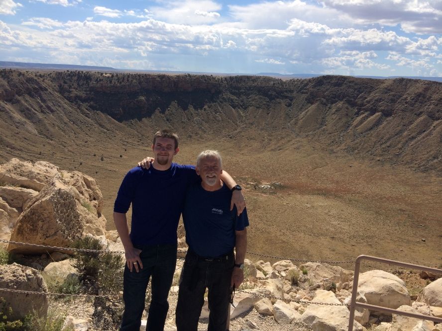
I had a great visit with my son, a sophomore at Northern AZ U; he’s doing great there and loves it, but he won’t be home till Christmas, so that made the visit more special to me. We took one ride together, about 50 miles east from Flag to Meteor Crater, which I found fascinating. Privately owned, I didn’t know what to expect for my $18 (!) admission, but they had a really first class museum and visitor center. It’s one of those places that you just don’t “get” till you stand up on the rim and look down inside. It’s fascinating.
But once I left Flag, I was “smelling the barn,” and just wanted to get home. I’ve made the trip several times between there and here, or between Flag and Las Vegas, so this time I rode north toward Page, AZ, and then took a “scenic byway” (89A) over toward Kanab where SW-FOG will be, rode past the Vermillion Cliffs area, and stopped at the Mountain Meadows Massacre site in Utah, which is as understated as it could possibly be. There’s a plaque saying that it was named a historical site by the federal government “for events that occurred here,” and a wooden sign or bulletin board nearby that is . . . blank. A gravel footpath off the tiny gravel parking area leads to a memorial I did not hike a quarter mile uphill to see. It’s almost like the Utah government doesn’t really want to talk about it.
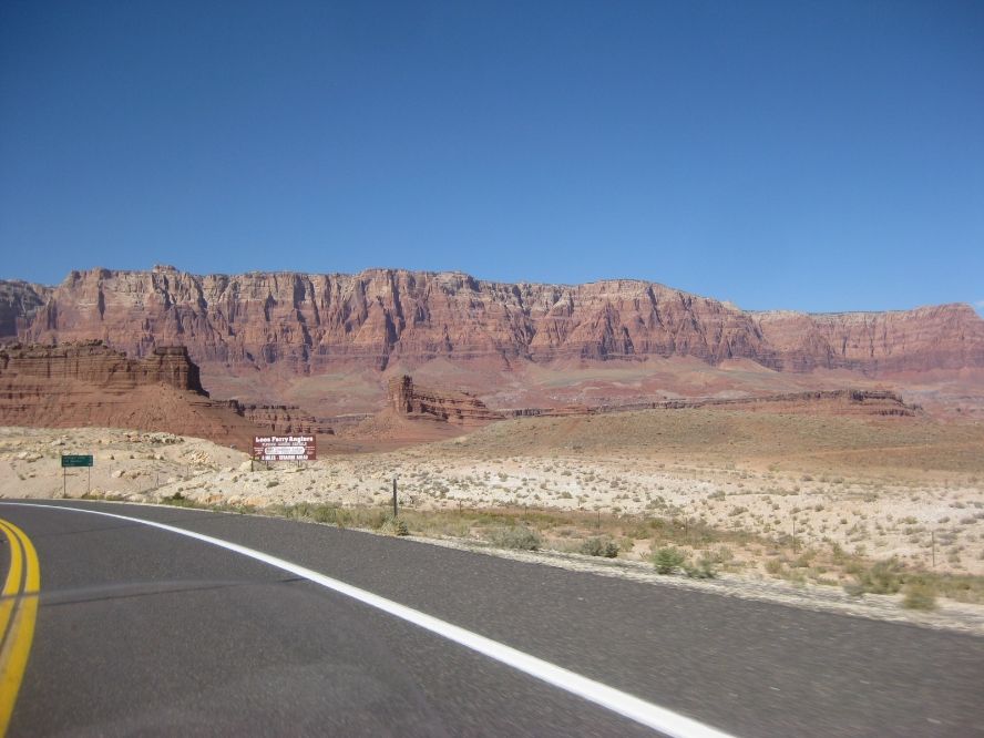
Vermillion Cliffs
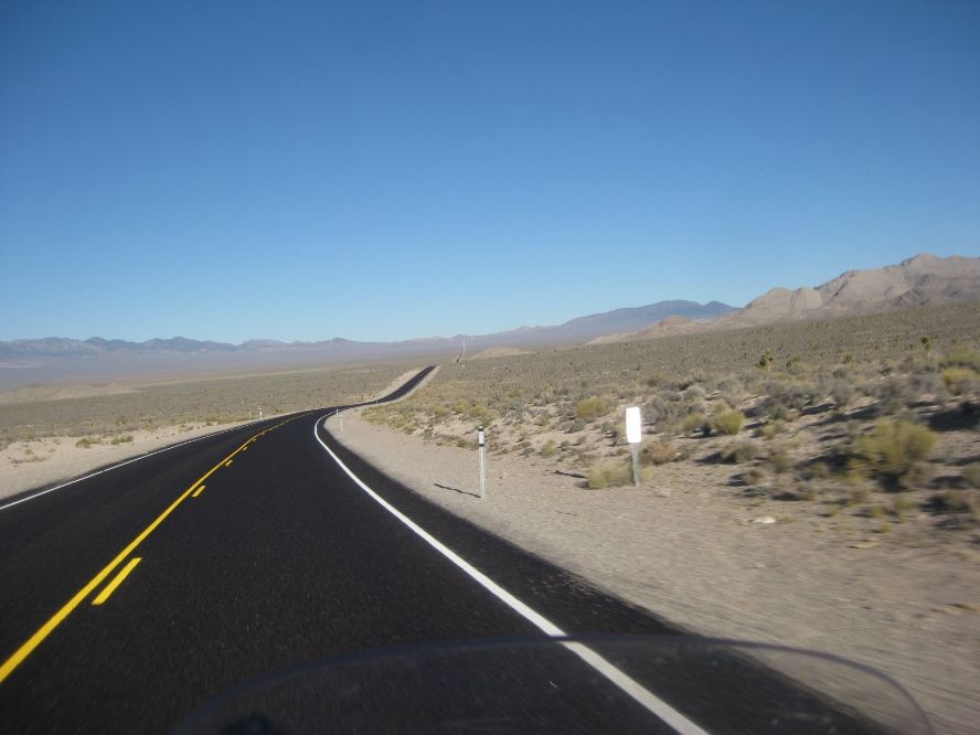
Some parts of the Southwest are pretty empty. But hey, I was almost home. Spent one more night on the road in Caliente, NV and left early for Sacramento--one last 569 mile day. Total miles for the trip, 9,553. Here's that Spotwalla link again.
I wish the run home through the south could have made a more crooked line on the map. Maybe next trip. The PR4s that started with about 1K on them made it all the way. They show plenty of wear, but are still rideable for a little while. I won’t be waiting long for a new set, though. I got a lot of encouragement and help from lots of folks on the forum, offers of lodging if I came through near them, route help, etc. Thanks to all for that. I also relied quite a lot on “the kindness of strangers” who knew their local roads and freely offered help and advice many times, and I thank them too. And thanks for looking at a report that was darn near as long and windy as the trip.
"These are my principles. If you don't like them, I have others." Groucho Marx"Consider the daffodil. And while you're doing that, I'll be over here, looking through your stuff." Jack Handy"Watch out for that tree!" George of the Jungle
